
Even better, sometime aerial photography shows that the landscape still contains traces of certain Middle Age charters. The territory has a circular contour that defines the zone covered by the "Law" granted in 1210. Quite often, villages that had been granted a charter take on this more or less obvious circular aspect, such as at Bouillancourt-en-Séry or Ergnies (Somme).
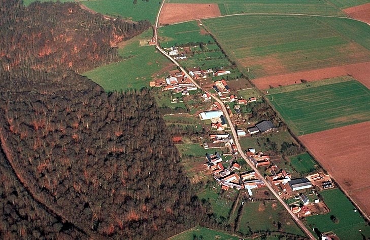
The same is true of large and small villages that were fortified, like at Hiermont (Somme). The typology of these towns can reveal their history, and this can be clearly seen from the air, as well as on IGN 1:50,000 scale maps. Thus, village-streets created by medieval land-clearing practices are quite evident at Longuevillette (Somme) and at Saint Nicolas d'Aliermont (Seine-Maritime).
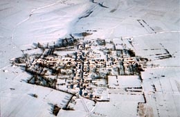
More exceptional are villages that, after a file in the distant past, were reconstructed according to a "Christian" town plan, which still can be seen at Varennes-en-Croix (Somme).
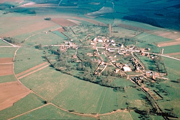
The boundary of the rights obtained in 1210 are still visible in the landscape in the form of two concentric circular paths. The one that surrounds the town is called the "tour de ville". Ergnies (Somme).
Village-street at Longuevillette (Somme).
The cross-shaped town plan of Varennes (Somme).